Sarajevo — the map that came first, how the Habsburgs surveyed Bosnia for three years before laying a stone
In December 1879 the Common Ministry in Vienna set up Die Cataster-Commission. Its job was to survey every square metre of Bosnia and Herzegovina. Between 1880 and 1882 it produced 1,417 detailed cadastral sheets covering every village, road, and field boundary in the two provinces. Only after the survey was complete, Kadkani-Schmitt argues in her 2017 Berkeley dissertation, did the Habsburg administration begin to build. The order — map before build — was the political act itself. Everything that followed was already decided by December 1882.
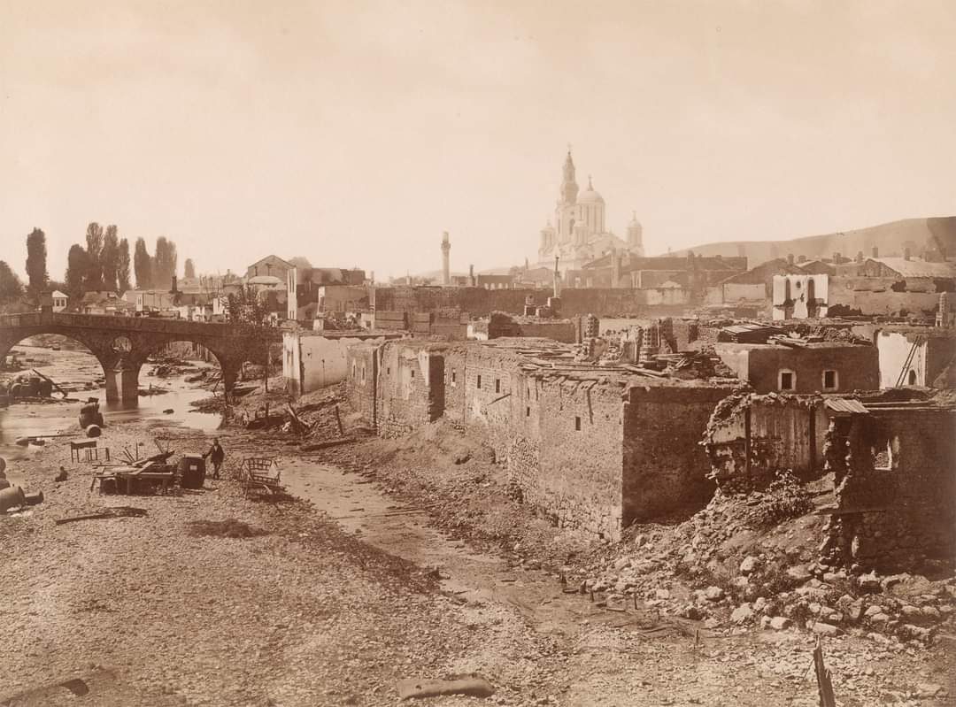
A certain kind of story about the Habsburg period in Sarajevo — the walking-tour story, the postcard story — goes like this: Austria-Hungary occupied Bosnia in 1878, and then they built beautiful buildings.
Not wrong. Just very compressed. What it leaves out is the seven-year gap in the middle, during which the Habsburg administration did something unphotogenic before the buildings started going up.
They mapped the province.
.jpg)
The Ministry, the Commission, and the map
The story opens in Vienna, December 1879. The Common Ministry of Finance, the joint Austro-Hungarian ministry that ran the newly occupied Bosnian portfolio, established a special bureaucratic unit called Die Cataster-Commission, the Cadastral Commission. Its members came from the Austrian and Hungarian civil services and the imperial army’s technical corps. The job: produce the first comprehensive cadastral survey of Bosnia and Herzegovina.
The Commission’s operational report lives in the Mitteilungen des k.u.k. Militärgeographischen Institutes (the Communications of the Imperial and Royal Military Geographical Institute), Vienna, volumes 1881 and 1885. Zahra Kadkani-Schmitt’s 2017 Berkeley dissertation Framing Bosnia summarises what those volumes show (Ch. 1), and the summary is worth pausing on.
Between December 1879 and January 1880, the Commission negotiated the ground rules for the survey. The goal, per the operational report, was that “through a fast-paced and effective plan, all occupied land down to the smallest detail would be recorded in such a full, clear, and exact manner as to facilitate the political and military authorities’ spatial intervention at any given moment” (Mitteilungen 1881, p. 79).
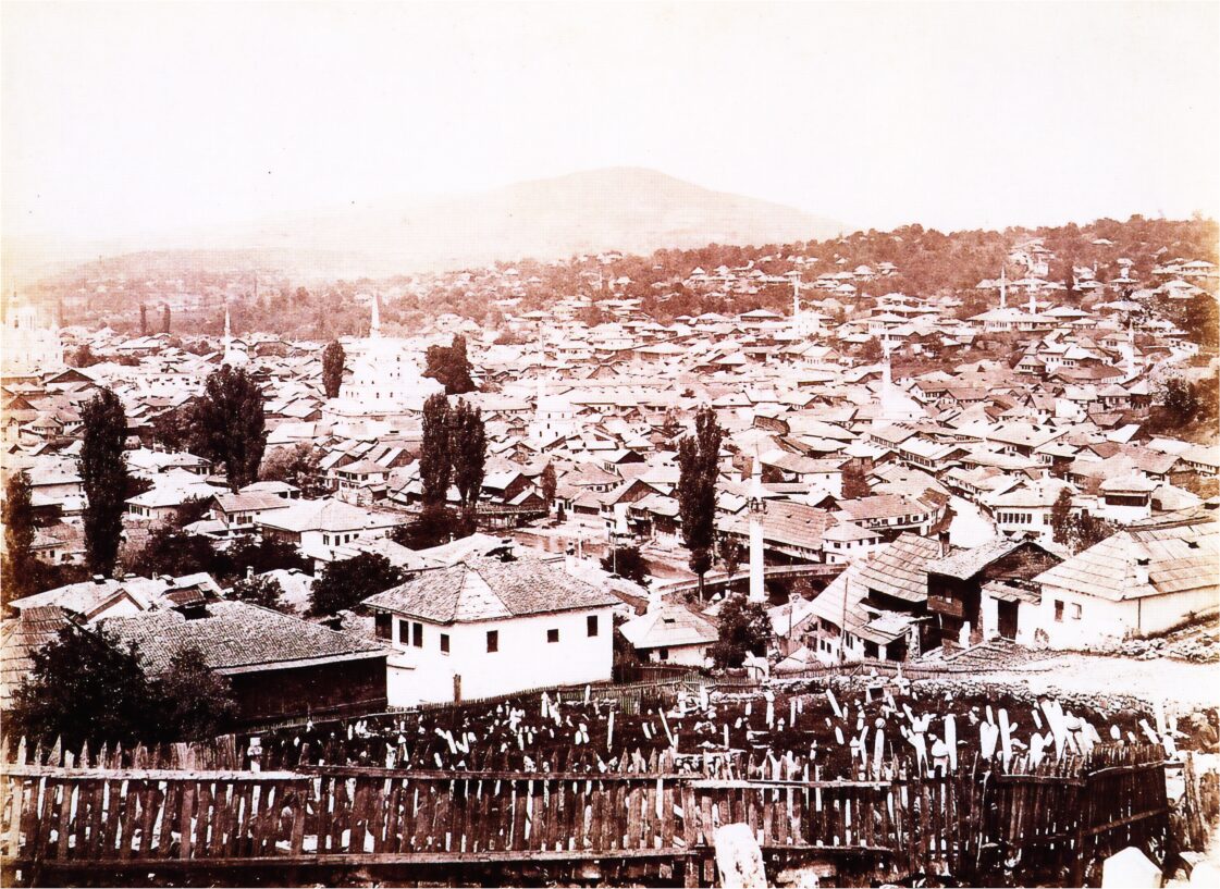
The survey ran from 1880 through the mid-1880s. The methodology mirrored the Habsburg monarchy’s own established cadastral system — the same system that had mapped Austria, Hungary, and the Habsburg crownlands during the reigns of Maria Theresa and Joseph II in the 18th century. What was unusual about the Bosnian case was the pace and detail. The report notes that “the uncompromisingly detailed and modern mapping of Bosnia and Herzegovina was taking place in a fashion not to be found in many other Austrian provinces at that time” (Mitteilungen 1881, p. 77).
The Habsburgs mapped their newest and least-familiar province more thoroughly than provinces they had held for centuries.

Why the map came first
Kadkani-Schmitt’s argument — and the reason her dissertation is worth citing for anyone thinking about Sarajevo’s architecture — is that the mapping was not merely an administrative preliminary before the “real” work of building started. The mapping was the real work. Or, more precisely, the mapping was the political precondition of everything that came after: the building programme, the tax collection, the conscription (see the 1882 revolt against Habsburg conscription), the entire imperial re-ordering of the province.
Three reasons.
One: legibility. Larry Wolff, in Inventing Eastern Europe (Stanford, 1994), argues that the European Enlightenment’s most enduring gift to the 19th-century imperial project was the conviction that unmapped territory was, in some sense, uncivilised. Making a province legible on paper meant bringing it into the fold of European rationality. Or, in James C. Scott’s later phrase, mapping is the tool by which the state converts “human multiplicities” into “manageable unity” (Seeing Like a State, Yale, 1998). Kadkani-Schmitt draws on both. Before 1880, the Habsburg administration could not administer Bosnia because it could not see Bosnia. After 1885, it could.
Two: taxation. The occupation operated under an imperial order to be financially self-sufficient — Vienna had told the Delegations, in the political fight that preceded the 1878 invasion, that Bosnia would not be a fiscal drain on the monarchy. Every road built, every barracks garrisoned, every civil servant paid, had to come from taxes raised inside the province. To tax property, the administration had to know what property existed and who owned it. The Ottoman system had recorded land in relatively vague terms — descriptions rather than measured plots, family names rather than surveyed boundaries. Under the new system every plot became a rectangle with an owner’s name and a tax obligation. The mechanism that fed the peasant grievances exploding in the 1882 revolt.
Three: military mobility. Kadkani-Schmitt cites the imperial army’s engineer Philipp Ballif (1847–1905), the chief engineer who built much of the province’s Habsburg-era road and rail infrastructure. In 1879, before the survey started, Ballif travelled from Sarajevo to Bosanski Brod on the Sava — roughly 220 kilometres — and it took him eight days, changing horse daily. That was the road network the Ottoman administration had left the Habsburgs. Too slow to move troops; too slow to answer an armed uprising. Every road subsequently built by Ballif’s engineers was built on the survey’s base map.
The six Kreise (regions) the Habsburg administration divided Bosnia into, Sarajevo, Travnik, Bihać, Donja Tuzla, Banja Luka, Mostar, and the 54 Bezirke (districts) below them were drawn on the base map the Commission produced. So were the routes of the roads. So were the railway lines. So were the perimeters of the cities within which the new building codes (see the Bau-Ordnung of 1880, the ordinance that dictated the yellow-plaster Neo-Baroque façades of central Sarajevo) would take force.
The map came first. Everything else came after.
What the survey looked like on paper
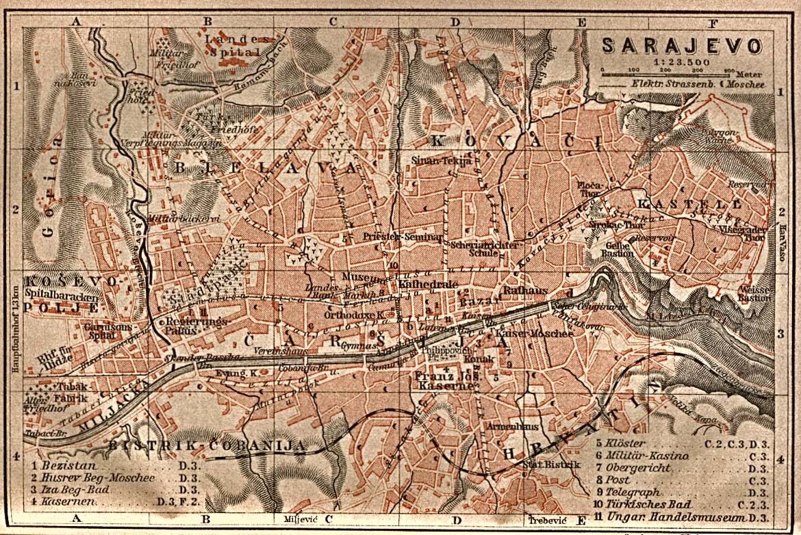
The Commission’s base output: a set of 1:2,500 cadastral sheets for the settled areas and 1:25,000 topographic sheets for the wider territory. The topographic sheets became the standard reference map of Bosnia and Herzegovina for the remainder of the Habsburg period and into the interwar Yugoslav administration. The 1905 tourist plan of downtown Sarajevo (reproduced in Kadkani-Schmitt as her Figure 28) is, essentially, an extract from the Commission’s 1880s base map with the newer buildings added.
The cadastral sheets — the 1:2,500 property-level ones — became the legal basis of the province’s post-1885 land registry (zemljišna knjiga). That registry, with subsequent revisions, is still the working land registry of the Federation of Bosnia and Herzegovina today. When you buy a property in Sarajevo now, the ownership chain your notary will trace runs back through the Yugoslav-era registry, into the Habsburg-era registry, into the Cataster-Commission’s 1880s survey sheets. Beyond that point the record becomes Ottoman sijills and family recollection.

Why this belongs on a travel site
Two reasons, one of them small and one of them not.
Small. The most photographed street in Sarajevo, the pedestrianised Ferhadija, runs along a straight east-west axis that is, essentially, a Habsburg-era decision. The medieval and Ottoman city was denser, more organic, more curved. What you photograph on Ferhadija was straightened, widened, and paved during the period the Cataster-Commission’s base map made planable. The buildings on either side were commissioned once the plots underneath them were mapped.
Not small. The tension the site returns to often — the meeting of East and West that Sarajevo is sometimes reduced to a slogan about — is not, in most of the ways that matter, an architectural tension. An administrative one. The Ottomans governed by relationships. The Habsburgs governed by rectangles. The transition from one to the other happened, in the Bosnian case, on the drawing tables of the Cataster-Commission between December 1879 and roughly 1885, before the first Habsburg-era public building in Sarajevo was even commissioned.
The story the walking guides skip, and the story the buildings themselves are the answer to.
Where to see the traces on the ground
-
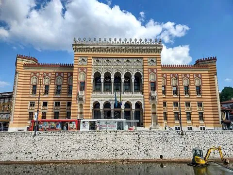
Vijećnica: the most photographed Habsburg building in Sarajevo. Commissioning began in 1892, seven years after the base cadastral survey was substantially complete. The plot it sits on is a Cataster-Commission rectangle.
-
National Museum of Bosnia and Herzegovina: the National Museum holds a working archive of the Habsburg-era administrative records, including cadastral fragments and the Topič photograph collection that documents the mapped city.
-
Ferhadija: walk it once with the survey in mind. The straightness of the axis is the Habsburg answer to the Ottoman city’s curvature.
-
The land registry office: Kantonalna geodetska uprava, ul. Reisa Džemaludina Čauševića, if you want to see the working continuation of the Cataster-Commission’s survey in its current administrative form. Not a tourist attraction. Property titles are still registered here on the base grid the imperial army’s engineers laid down.
Sources
- Zahra Kadkani-Schmitt, Framing Bosnia: The Politics of Architecture and City Building in the Austro-Hungarian Administration of Bosnia and Hercegovina, 1878–1903 — PhD dissertation, UC Berkeley, 2017. Chapter 1 is the source that made this article possible. eScholarship link.
- Mitteilungen des k.u.k. Militärgeographischen Institutes: Vienna, volumes 1881 and 1885, the operational reports of the imperial army’s Military Geographical Institute. Original archive: Österreichische Nationalbibliothek. ONB digital catalogue link.
- Larry Wolff, Inventing Eastern Europe: The Map of Civilization on the Mind of the Enlightenment — Stanford University Press, 1994. Chapter 4, “Mapping Eastern Europe,” is the theoretical background for reading cartography as an instrument of imperial identity. Stanford link.
- James C. Scott, Seeing Like a State: How Certain Schemes to Improve the Human Condition Have Failed — Yale University Press, 1998. Part I on legibility and simplification is the essential complement to Wolff.
- Peter Sugar, The Industrialization of Bosnia-Hercegovina, 1878–1918 — University of Washington Press, 1963. The economic history that reads the survey in the context of the province’s fiscal self-sufficiency mandate.
Sources & further reading
Keep reading
More from the guide.

Sarajevo — the royal Kotromanić stećak is thirty steps from the National Museum entrance
Bosnia and Herzegovina has about seventy thousand medieval tombstones called stećci. They stand across the country in scattered necropolises, and since 2016...
Sarajevo 1912 — the Bosnian Parliament the Habsburgs planned across the river from Vijećnica, and the First World War stopped
Directly across the Miljacka from Vijećnica, on the south embankment near the Cumurija bridge, there was once supposed to be a big...

Sarajevo's iron fences — the pheasant on Sime Milutinovića 15, and other pieces you walk past
Push a heavy oak door open in a Habsburg-era palace on Strossmayerova, or Vrazova, or Obala Kulina bana, and look up. The...